You seem to be using an older version of Internet Explorer. This site requires Internet Explorer 8 or higher. Update your browser here today to fully enjoy all the marvels of this site.
April 6, 2018 by Alexander Meldrum
The Caledonian Canal
The Caledonian Canal connects the Scottish east coast at Inverness with the west coast at Corpach near Fort William in Scotland.
The canal was constructed in the early ninet...The Caledonian Canal
The Caledonian Canal connects the Scottish east coast at Inverness with the west coast at Corpach near Fort William in Scotland.
The canal was constructed in the early nineteenth century by Scottish engineer Thomas Telford, and is a sister canal of the Göta Canal in Sweden, also constructed by Telford.
The canal runs some 60 miles (97 km) from northeast to southwest. Only one third of the entire length is man-made, the rest being formed by Loch Dochfour, Loch Ness, Loch Oich, and Loch Lochy.
These lochs are located in the Great Glen, on a geological fault in the Earth's crust. There are 29 locks (including eight at Neptune's Staircase, Banavie), four aqueducts and 10 bridges in the course of the canal.
History
In 1620, a Highland prophet called the Brahan Seer predicted that full-rigged ships would one day be sailing round the back of Tomnahurick, near Inverness, at a time when the only navigable route near the location was the River Ness,
on the other side of Tomnahurick. Engineers started to look at the feasibility of a canal to connect Loch Linnhe near Fort William to the Moray Firth near Inverness in the 18th century,
with Captain Edward Burt rejecting the idea in 1726, as he thought the mountains would channel the wind and make navigation too precarious.
The Commissioners of Forfeited Estates had originally been set up to handle the seizure and sale of land previously owned by those who had been convicted of treason following the Jacobite rising of 1715.
By 1773, they had turned their attention to helping the fishing industry, and commissioned the inventor and mechanical engineer James Watt to make a survey of the route.
He published a report in 1774, which suggested that a 10-foot (3.0 m) canal from Fort William to Inverness, passing through Loch Lochy, Loch Oich, Loch Ness and Loch Dochfour, would require 32 locks,
and could be built for £164,032. He emphasised the benefits to the fishing industry, of a shorter and safer route from the east to the west coast of Scotland, and the potential for supplying the population with cheaper corn,
but again, thought that winds on the lochs might be a problem. Although no action was taken at the time, in 1785 John Knox expounded the benefits of it relieving distress in the Highlands,
and preventing ships having to navigate the dangerous Pentland Firth between the Orkney Islands and Caithness. William Fraser, when proposing his own scheme for a canal in 1793,
announced that "nature had finished more than half of it already".At the time, much of the Highlands were depressed as a result of the Highland Clearances, which had deprived many of their homes and jobs.
Laws had been introduced which sought to eradicate the local culture, including bans on wearing tartan, playing the bagpipes, and speaking Gaelic. Many emigrated to Canada or elsewhere, or moved to the Scottish Lowlands.
The engineer Thomas Telford was asked to investigate the problem of emigration in 1801, and in 1802 published his report, which suggested that the problem was caused by landowners
who had previously kept cattle creating vast sheep-farms. Realising that direct government action to tackle the issue would be seen as interference, he therefore suggested that a programme of public works,
involving roads, bridges and canals, would be a way to provide jobs for people who had been displaced by the sheep farming, and to stimulate industry, fishery and agriculture.
Telford consulted widely with shipowners, who favoured a canal instead of the hazardous journey around the north of Scotland via Cape Wrath and the Pentland Firth.
He obtained advice from Captain Gwynn of the Royal Navy, who stated that Loch Ness and Loch Lochy were sufficiently deep for any size of boat, and had safe anchorages if winds proved to be a problem,
but that Loch Oich would need to be made deeper, as it was shallow in places. He established that Loch Garry, to the west of Invergarry, and Loch Quoich, beyond that, would provide an adequate water supply.
He estimated that a canal suitable for ships with a draught of 20 feet (6.1 m) could be built in seven years, and would cost around £350,000.
An additional benefit would be the protection that the canal offered to shipping from attacks by French privateers. Telford also looked at the possibility of a canal to link Loch Eil to Loch Shiel,
both to the west of Fort William, but ruled out the scheme because of the depth of cuttings that would have been required.
Because of the remoteness of the location, construction was started at both ends, so that completed sections could be used to bring in the materials for the middle sections.
As Thomas Telford could only visit the work about twice a year, he appointed Matthew Davidson, like Telford, a Dumfrieshire stonemason, to manage the work at the east end.
John Telford, who is thought not to have been related to Thomas, was to manage the difficult western end. The work was to prove a serious challenge to John Telford's health and he died in 1807, to be replaced by Alexander Easton.
John Telford was buried in Kilmallie churchyard, where his ornate grave, now in dilapidated condition, can still be seen.
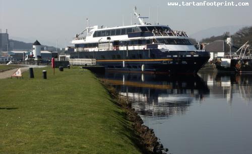
The canal is now a Scheduled Ancient Monument, and attracts over half a million visitors each year. British Waterways, who work with the Highland Council and the Scottish Forestry Commission through the Great Glen Ways Initiative,
were hoping to increase this number to over 1 million by 2012. There are many ways for tourists to enjoy the canal, such as taking part in the Great Glen Rally, cycling along the tow-paths, or cruising on Hotel Barges.
In this photo:
